Supermarket nearby Konzum
Bosnia and Herzegovina
Supermarket nearby Konzum
Konzum
Sarajewo 71000, Bośnia i Hercegowina
contacts phone
:
+387
Latitude:
43.8504678
, Longitude:
18.4111293
larger map & directions
read more
nearest Supermarket
569 m
Konzum
Sarajevo City Center, sprat -1, Vrbanja 1, Sarajevo
Supermarket
read more
646 m
Konzum
Skenderija, Sarajevo
Supermarket
read more
655 m
Konzum
Vladimira Perića - Valtera 8, Sarajevo
Supermarket
read more
687 m
Amko
71000, Skenderija 25, Sarajevo
Supermarket
read more
784 m
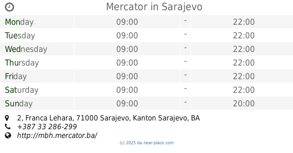
Mercator
Franca Lehara 2, Sarajevo
Supermarket
read more
789 m
Konzum
-1, Franca Lehara 2, Sarajevo
Supermarket
read more
1.001 km
Konzum
-1, Trg djece Sarajeva 1, Sarajevo
Supermarket
read more
1.007 km
Konzum
71000, Branilaca Sarajeva 4, Sarajevo
Supermarket
read more
1.232 km
Konzum
Grbavička 46, Sarajevo
Supermarket
read more
1.258 km
Klas
71000, Grbavička 52, Sarajevo
Supermarket
read more
1.295 km
Amko komerc
71000, Grbavička 40, Sarajevo
Supermarket
read more
1.563 km
Amko Komerc d.o.o.
Merhemića trg 7, Sarajevo 71000, Sarajevo
Supermarket
read more
1.596 km
Best BiH
Unnamed Road, Sarajevo 71000
Supermarket
read more
1.717 km
FRANO SUPILO d.o.o, diskont pića
Patriotske lige 14, Sarajevo
Supermarket
read more
1.771 km
Penny Market
Halida Kajtaza, Sarajevo
Supermarket
read more
1.958 km
Amko
Zaima Šarca 26, Sarajevo
Supermarket
read more
2.082 km
Bingo
Aleja Lipa 55, Sarajevo
Supermarket
read more
2.186 km
Amko
Trg heroja 25, Sarajevo
Supermarket
read more
2.545 km
Amko
Azize Šaćirbegović 14, Sarajevo
Supermarket
read more
2.879 km
Klas Centar
71000, Paromlinska 56, Sarajevo
Supermarket
read more
3.202 km
Mercator
Džemala Bijedića 11, Sarajevo
Supermarket
read more
3.307 km
Konzum
Gradačačka 56, Sarajevo
Supermarket
read more
3.435 km
Amko
Prijedorska 11a, Sarajevo
Supermarket
read more
3.457 km
Bingo Hipermarket
Gradačačka, Sarajevo
Supermarket
read more
5.384 km
Bingo Dobrinja Pj32
Hamdije Kapidžića 8, Sarajevo
Supermarket
read more
📑
all categories
Accounting
Administrative area level 1
Administrative area level 2
Airport
Amusement park
Art gallery
Atm
Bakery
Bank
Bar
Beauty salon
Bicycle store
Book store
Bowling alley
Bus station
Cafe
Campground
Car dealer
Car rental
Car repair
Car wash
Casino
Cemetery
Church
City hall
Clothing store
Convenience store
Country
Courthouse
Dentist
Department store
Doctor
Electrician
Electronics store
Embassy
Establishment
Finance
Fire station
Florist
Food
Funeral home
Furniture store
Gas station
General contractor
Grocery or supermarket
Gym
Hair care
Hardware store
Health
Home goods store
Hospital
Insurance agency
Jewelry store
Laundry
Lawyer
Library
Light rail station
Liquor store
Local government office
Locality
Locksmith
Lodging
Meal delivery
Meal takeaway
Mosque
Movie rental
Movie theater
Moving company
Museum
Natural feature
Neighborhood
Night club
Park
Parking
Pet store
Pharmacy
Place of worship
Point of interest
Police
Post office
Premise
Real estate agency
Restaurant
Roofing contractor
Route
Rv park, camping
School
Shoe store
Shopping mall
Spa
Stadium
Storage
Store
Supermarket
Synagogue
Taxi stand
Train station
Transit station
Travel agency
University
Veterinary care
Zoo
administrative area level 3
sublocality level 1
↑