Cemetery nearby pravoslavno groblje Zagorice
Bosnia and Herzegovina
Cemetery nearby pravoslavno groblje Zagorice
pravoslavno groblje Zagorice
Zagorice, Bosnia-Herzegovina
contacts phone
:
+387
Latitude:
43.6508642
, Longitude:
17.9902471
larger map & directions
read more
nearest Cemetery
2.031 km
Gradsko Groblje
Konjic
Cemetery
read more
2.037 km
Groblje Musala
Konjic
Cemetery
read more
2.05 km
staro gradsko mezarje konjic
Konjic
Cemetery
read more
2.099 km
Partizansko groblje
Musala, Konjic
Cemetery
read more
3.523 km
Katoličko groblje
Donje Selo
Cemetery
read more
28.152 km
Mezarje Binježevo
Hadžići
Cemetery
read more
29.928 km
Groblje Kovači
Sarajevo
Cemetery
read more
30.131 km
Pravoslavno groblje Blažuj-Vrelo Bosne
Bosnia y Herzegovina
Cemetery
read more
30.139 km
Pravoslavna crkva sv. Save u Blažuju sa grobljem
Ilidža
Cemetery
read more
31.519 km
Gradsko groblje Vlakovo
Vlakovo
Cemetery
read more
35.84 km
Гробље Врањеш
71123, Jovana Dučića 5, Lukavica
Cemetery
read more
37.767 km
Partisan's Cemetery
Mostar
Cemetery
read more
38.134 km
Groblje Obad
Novo Sarajevo
Cemetery
read more
38.497 km
Groblje MILJEVIĆI
Istočno Novo Sarajevo
Cemetery
read more
38.737 km
Groblje Masline
Mostar
Cemetery
read more
39.087 km
Groblje Miljevići
Bosnia and Herzegovina
Cemetery
read more
40.178 km
Cmentarz żydowski
Sarajevo
Cemetery
read more
40.195 km
Old Jewish cemetery
Gabrielle Moreno Locatelli 11,Sarajevo 71000, Sarajevo
Cemetery
read more
40.208 km
Jevrejsko groblje u Sarajevu, grobljanska cjelina
Gabrielle Moreno Locatelli 11,Sarajevo 71000, Sarajevo
Cemetery
read more
41.409 km
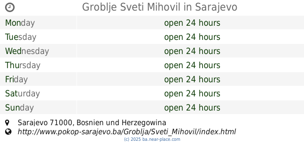
Groblje Sveti Mihovil
Sarajevo
Cemetery
read more
41.53 km
Groblje Sveti Josip
Ciglane bb, Sarajevo
Cemetery
read more
41.583 km
Groblje Sveti Marko
Patriotske lige, Sarajevo
Cemetery
read more
42.645 km
Šehidsko mezarje Kovači
Sarajevo
Cemetery
read more
42.647 km
Groblje Alifakovac
Veliki Alifakovac, Sarajevo
Cemetery
read more
42.749 km
Grave of Alija Izetbegović in the Kovači War Memorial and Cemetary
Sarajevo
Cemetery
read more
📑
all categories
Accounting
Administrative area level 1
Administrative area level 2
Airport
Amusement park
Art gallery
Atm
Bakery
Bank
Bar
Beauty salon
Bicycle store
Book store
Bowling alley
Bus station
Cafe
Campground
Car dealer
Car rental
Car repair
Car wash
Casino
Cemetery
Church
City hall
Clothing store
Convenience store
Country
Courthouse
Dentist
Department store
Doctor
Electrician
Electronics store
Embassy
Establishment
Finance
Fire station
Florist
Food
Funeral home
Furniture store
Gas station
General contractor
Grocery or supermarket
Gym
Hair care
Hardware store
Health
Home goods store
Hospital
Insurance agency
Jewelry store
Laundry
Lawyer
Library
Light rail station
Liquor store
Local government office
Locality
Locksmith
Lodging
Meal delivery
Meal takeaway
Mosque
Movie rental
Movie theater
Moving company
Museum
Natural feature
Neighborhood
Night club
Park
Parking
Pet store
Pharmacy
Place of worship
Point of interest
Police
Post office
Premise
Real estate agency
Restaurant
Roofing contractor
Route
Rv park, camping
School
Shoe store
Shopping mall
Spa
Stadium
Storage
Store
Supermarket
Synagogue
Taxi stand
Train station
Transit station
Travel agency
University
Veterinary care
Zoo
administrative area level 3
sublocality level 1
↑